 Viewpoint at 13th Beach – Victoria
With the Great Ocean Road behind us we were on the next major leg of our cycling tour across Australia to the Pacific Coast. After taking the coastal road track from Torquay via the very beautiful 13th Beach, we arrived in a compact and very pretty Queenscliffe on the Western inlet of Port Phillip Bay. Finding the Queenscliff Tourist Park on the foreshore was easy and the sun had everyone in a good mood.The park is well situated, just a short walk from the main street and has a great camp kitchen, clean amenities and good grassed sites. Queenscliffe’s main street is lined with old colonial style buildings that lend a lot of character to the town. Dining on the footpath seemed to be obligatory today as hordes of visitors enjoyed the rare blue skies and a pleasant sea breeze.

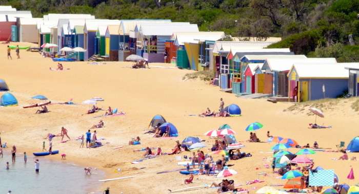
Kite Surfing – 13th Beach
We paid $10 each to board the ferry to Sorrento the next morning (our bikes were free). The crossing takes about an hour, plenty of time for a coffee and to study our maps. We would head up to Mornington around the peninsula and then head east to Warragul.
The ride up to Mornington was shoulder to shoulder with some of the heaviest traffic we’d seen. The whole foreshore is set aside for camping and it was choc-a-bloc!! Everything rolled smoothly until we found out why Mt Martha has Mt in its name!! In a throw-back to the Great Ocean Road we ascended the mountain road with nothing but sea views and cliffs on our left hand side. At the end of the breath-taking climb, the road turned a corner and began a roller-coaster frolic with views all the way to Mornington.
We had lunch in the busy main street before heading out to the edge of town to the Mornington Gardens Holiday Park. It was a great park with shady grassed sites, very clean amenities, a well equipped camp kitchen, library and recreation room but we’d left ourselves around a 2 km walk to the nearest shops to buy something to cook for dinner.

Downtown Queenscliffe on a sunny day.
The next morning saw us make our way East across the Mornington Peninsula in peak hour traffic. We had ignored Goggle Map’s suggestions to take another road and had simply turned right outside the caravan park gates and followed Bungower Road all the way to Tooradan. Bad mistake. The road is really flat BUT there is no shoulder for much of the way and it’s really, really busy. It was a timely reminder that we are in the heart of one of the most populous areas in Australia. Take a look at Victoria the next time you have a map out – it’s overrun with people. It’s like we’ve entered a busy shopping centre in Asia from the back door entrance of a bush town – instant crowds!

Pulling into Sorrento Pier
We managed to leave the pressures of the highway behind us at Koo Wee Rup. There we headed North to the tiny Bayles where we were grateful to find a small air conditioned café that sold cold drinks. It was definitely heating up. Something we and’t seen too much of til now.
Our planned route to Drouin (our first choice stop) was vague at best and the GPS on Google Maps was confusing the issue even further. We eventually cycled up to Longwarry, 10kms west of Drouin where an old local fella suggested yet another way to go. We had another cold drink and decided on the shortest, most direct way – to Warragul!!! We’d ignored the GPS in the morning and paid by having no shoulder on the road. Surely the GPS would take us the most bike friendly way…surely???

Beach on the Mornington Peninsula
What proceeded was one endless hill climb session that left Shazz dry retching at one point. The whole experience was compounded by the fact that I needed to keep taking the Samsung out to check our position. The route was so convoluted I could only remember 4 or 5 turns at a time and the fact that we had to make our way through some new estates left us confused and totally frustrated as they weren’t even on the map!!! At one point we had to get off the bikes and push them almost vertically 300m uphill to the top of the range that Drouin sits on. One guy tool pity and gave Shazz a cold bottle of water. What would the rest of the trip be like if it was all like this???
After several more sharp climbs we eventually came into Warragul. It had taken 4 hours to do the last 20 kms and we were shattered. The Warragul Gardens Holiday Park was quite nice with a great shady, green pitch and a cool, refreshing pool so we decided to stay an extra day and get back into the right frame of mind for whatever might come our way on the rest of the journey East. It certainly had us in two minds as to whether to trust Google Maps ever again as the locals told us the best way was to simply take the Princes Highway as there were good shoulders and gradual slopes. Oh well, I’m sure it was great training for the hills we’ll be heading into as we approach the Pacific Coast.
Note: I do not receive any payment for this post (or any others on the site for that matter!). I do receive a small amount of money by allowing advertisements on the site and any purchases made through those links.


My spouse and I absolutely love your blog and find the majority of your post’s to be
just what I’m looking for. Does one offer guest writers to write content for yourself?
I wouldn’t mind writing a post or elaborating on most of the subjects you write regarding here.
Again, awesome blog!
All the writing at the moment is mine. I’d welcome a few guest posts at the moment as we are currently stationary in Ho Chi Minh City and I’m busy developing another website. Let me know what you have in mind and as long as it fits with the content and integrity of the site I’d be happy to publsih. Unfortunately no payment is possible but happy to put in backlinks and promote on all my social meadia networs